|
|
|
Operating With a GPS |
|
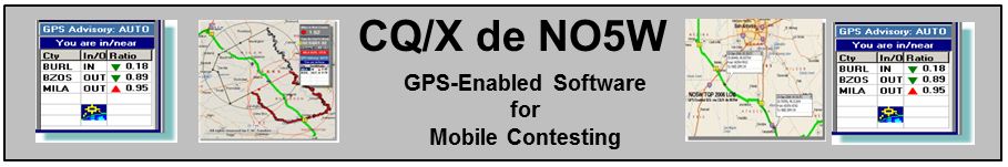
CQ/X can be operated at several different levels when a GPS is in use. These levels are mainly related to the amount of pre-planning that the user is required to perform ranging from virtually no planning to detailed planning including development of county line crossing locations, timing analysis, definition of waypoints, etc. Here is a description of the options including the amount of planning required and its impact on the available functionality. GPS Option 1: No Route Information In this case a GPS is in use, and of course connected to CQ/X, but the user does not provide any information about where the route will go. The responsibility for informing CQ/X in which county the operation is taking place and to change the county as the trip progresses is delegated to the GPS processing logic within CQ/X. This logic reads the latitude and longitude from the GPS and determines in which county the vehicle is currently located. When a new county is detected all county-dependent messages are automatically changed by the CQ/X logic as is the logged county and any duping parameters. The advantage of this option is that beyond procuring a GPS and interfacing it to CQ/X no pre-contest work is required on the part of the user. On the other hand a disadvantage to this option is that CQ/X has no way of determining time and distance to next county or to any highway turns, etc. GPS Option 2: Route Information as a Sequence of County Line Crossing Points Under this option the automatic detection of the current county, as in GPS Option 1, remains in effect. The additional route information supplied by the user, describing where county lines are to be crossed and the order in which these crossings are planned to occur, allows CQ/X to keep the user informed of the name of the next county, the driving distance to the next county, and an estimate of the time required to reach it based on current speed. The determination of the county line crossing points is performed by CQ/X and no maual entry of lat/lon values is required. In order to supply the required route information the user designs the route using a trip planning tool like Streets and Trips (S&T) and exports a file describing the trip plan. Using this file and a process outlined in Crossings Locator and in detail in this document, CQ/X is used to determine the latitude and longitude of each crossing and the sequence in which the crossings will occur. This process uses Google Maps to obtain a file containing the sequence of latitudes and longitudes that describe the route which of course requires internet connectivity during the planning phase but once the lat/lon file is obtained there is no longer this requirement. The additional functionality that this option enables in CQ/X concerning distance and time to next county can be useful in determining whether it might be necessary to stop or slow down in order to work down the pileup or perhaps speed up because the pile up has dissipated. Also when working a station and noting that the next county is only a few minutes away it can be useful to inform the station of that fact so that he will be waiting when you cross into the new county. This option also allows CQ/X to provide the user with information about how long he has been in the current county and the amount of time remaining before the next county, which can be useful in deciding whether to change bands and/or modes.
GPS Option 3: Addition of Waypoints to GPS Option 2 This option requires the most planning work on the part of the user but at the same time provides the most information during operation. In this option the automatic detection of the current county, as in the previous options, remains in effect as does the presentation of distance and estimated time to next county. The additional information supplied by the user is a file of latitude and longitude values describing the location of certain important waypoints along the route. The waypoints can be anything that the user considers important but probably the most useful is to define the points where there are turns or changes in the highway. Once the data for the latitude and longitude along with a descriptor are defined in Streets and Trips the data can be exported from S&T and imported into CQ/X. In operation this option allows the user to activate the Multi-waypoint tracker in CQ/X in order to have CQ/X present distance to upcoming turns and highway changes. With a proper description attached to each turn (e.g. LT-US19-FL40E) the operator can easily inform the driver of how far it is to the next turn. The Waypoint Tracker automatically determines distance to each waypoint and can be configured to present the next closest N waypoints or the next closest waypoints that are within a driving distance D of the current location. This can be of considerable assistance in keeping on the desired route. Defining the waypoints in S&T is a simple matter once the route is finalized. Simply go into the Directions panel in S&T, and then click on a highway change which will place a small mark on the S&T map. Place a pushpin at the mark and give it a descriptor that indicates the action to be taken (e.g. LT-US19-FL40E). Repeat this for each highway change. Once you are done use the S&T menu item Data | Export to GPX File. Then use the CQ/X menu item GPS | Define Waypoints to import those waypoints into CQ/X. With the addition of an Android phone or tablet and a wireless router a driver display can be provided which will allow the driver to see upcoming turns without interrupting the operator. Copyright: C.W. Sanders, NO5W Last Updated: 26-April-2020 |