|
|
|
Trip Simulation |
|
During
the early development of CQ/X it became apparent that driving 10-20
miles to the county line closest to the house in order to test
the performance of the county detection logic was not the most
efficient and safe approach. I needed an application that did not burn
gas and did not require any distracted driving. So a small application
was developed for recording and playing back GPS data. At first I would
record the data from a GPS while driving around a course
containing several county line crossings and use the recording in test
runs once I was back at the house. Eventually I dispensed with the
drive altogether and simply defined my test route in Google maps,
downloaded the lat/lon from Google maps and had the application
(SimGPS) create and playback the GPS sentences from the downloaded
lat/lon values. Here is a screen shot of SimGPS.
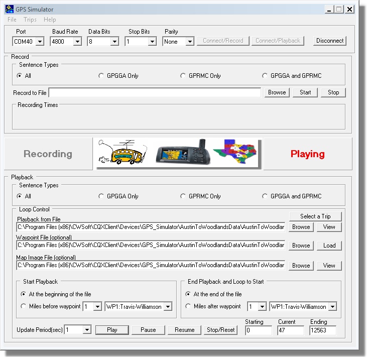 Under
the Trip menu you can elect to play a pre-recorded set of GPS sentences
from an actual drive or you can have SimGPS create
simulated GPS sentences from a file of lat/lon values
downloaded from Google maps. For a lengthy trip it is useful to define
waypoints so that the trip can be started and stopped a user-specified
number of miles before/after designated points along the path
of the trip as indicated in the Start Playback and End Playback areas
of the above dialog.
I have found SimGPS useful in the following ways
In addition to SimGPS, which is included in the CQ/X download, you will need a means of performing serial communication between SimGPS and CQ/X. The most efficient way to provide this communication path is by means of a virtual serial port (VSP) pair. VSP software is not included in the CQ/X download but there is VSP software which is freely available for ham radio non-commercial use from several sources on the internet including VSP Manager from K5FR, which I have found to be very easy to use and reliable. Copyright: C.W. Sanders, NO5W Last Updated: 26-April-2020 |